Save mission in cloud or local with DJI GS Pro
7152 13 2017-8-12
Uploading and Loding Picture ...(0/1)
o(^-^)o
Dronelink
New
France
Offline

Hello,

I wanna know if with DJI Groud Station Pro it's possible to save the mission from the Ipad to a Cloud or local folder?

In the App we can recall all missions but if i have some probleme with the ipad i lose all missions stored into. So i want to save the mission in a cloud like Litchi for example.
Maybe export data by Email or antother way.

I can't use Litchi because i need the Fonction "TAP" with aircraft of Ground Station Pro. Litchi doesn't have that function.


Thanks a lot.

Julien.

2017-8-12
Use props
DJI Diana
Administrator
Flight distance : 2408 ft

Offline

Can't, but we've submitted a request to our engineers, will take it into consideration.
2017-8-13
Use props
fans093bd610
New
Flight distance : 13173 ft
Canada
Offline

Is there a way to transfer your GSP missions from one tablet to another?
2017-8-14
Use props
DJI Susan
Administrator
Offline

fans093bd610 Posted at 2017-8-14 03:12
Is there a way to transfer your GSP missions from one tablet to another?

Sorry, it doesn't support such operation for now. Hopefully the engineers will consider it in the next update.
2017-8-14
Use props
Hi-FlyFoto
lvl.1
Flight distance : 27651 ft
Germany
Offline

Is there any update from the engineers on this issue?
For professional product, intended to be used by professionals
the export/import, cloud feature is a dealbreaker.
2017-12-5
Use props
WaldoPepper
lvl.1
Flight distance : 14098 ft
Germany
Offline


GS is a fine product, but seriously lacking
-Cloud support  for missions
-Logging capability (as with GO for services lke AirData)
2017-12-11
Use props
Oleksiy
lvl.3
Switzerland
Offline

I just performed a test flight with the DJI Ground Station Pro on the iPad Pro and the DJI Phantom 4 Pro. The flight was automatic along the mission way-points, which I created.

The images were downloaded to the iPad and combined into a orthorectified map image. The quality of the resulting map was quite good, despite that there was not much light outside today and that there were no distinct buildings with the correct shape. And it was done very quickly on the new iPad Pro. I am impressed.

However, I could not find out how to export this map image. I could only make a screen shot from the DJI GS Pro on the iPad:
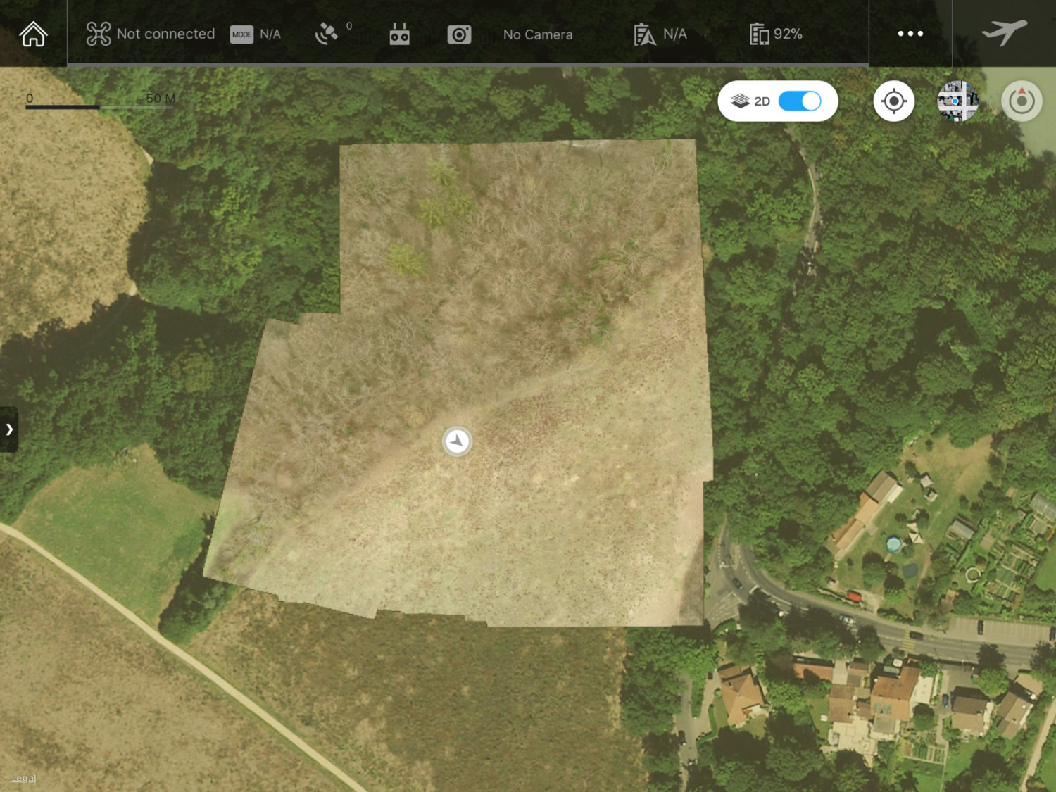

However, I need to make a map of an area, export it to my PC, add some text and symbols on it in a graphical editor, and then send it to other people. So if you, please, could remind your engineers of the export button.
2018-3-27
Use props
Oleksiy
lvl.3
Switzerland
Offline

Here is the mission itself:
2018-3-27
Use props
MrRobert5823
lvl.4
Flight distance : 1385223 ft
United States
Offline

I asked for this almost a year ago.... I can still hear the crickets....
2018-3-27
Use props
Pawell
lvl.4
Flight distance : 990256 ft
Poland
Offline

Oleksiy Posted at 2018-3-27 06:38
I just performed a test flight with the DJI Ground Station Pro on the iPad Pro and the DJI Phantom 4 Pro. The flight was automatic along the mission way-points, which I created.

The images were downloaded to the iPad and combined into a orthorectified map image. The quality of the resulting map was quite good, despite that there was not much light outside today and that there were no distinct buildings with the correct shape. And it was done very quickly on the new iPad Pro. I am impressed.

If you are serious about the orthophotos use a service like dronedeploy, Photoscan  or Pix4D, just take the images taken with GSpro and import it to these programs (try a trial of Pix4D, it is very intuitive).
I do photogrammetry at work, so if you have any questions just ask
2018-3-28
Use props
Oleksiy
lvl.3
Switzerland
Offline

Pawell Posted at 2018-3-28 00:21
If you are serious about the orthophotos use a service like dronedeploy, Photoscan  or Pix4D, just take the images taken with GSpro and import it to these programs (try a trial of Pix4D, it is very intuitive).
I do photogrammetry at work, so if you have any questions just ask

Pix4D and DroneDeploy are a bit expensive for me. With them I have to pay every month a significant amount.

I do aerial photography and mapping just for open source projects like OpenStreetMap, Wikimedia, etc. as a hobby.

I installed WebODM, it is a GUI interface to the OpenDroneMap, and it seems to work. At least better that the command line OpenDroneMap. I wait for clear weather to test it with practical data-sets.
2018-3-29
Use props
Sheps313
New

Australia
Offline

Any update on this? Pretty important feature as i have just spent a fair bit of time setting up various missions that i need to repeat precisely for the next couple of years.
2018-10-16
Use props
fansfcbd4d34
lvl.2
United States
Offline

I need to share saved missions from one iPad to another any update on this
2019-7-15
Use props
Deckz
lvl.1
  • >>>
Indonesia
Offline

There is still no updates for exporting mission from GSpro?
2021-2-23
Use props
Advanced
You need to log in before you can reply Login | Register now

Credit Rules