Windspeed indicator in DJI Go
4423 24 2017-3-3
Uploading and Loding Picture ...(0/1)
o(^-^)o
Quamera
lvl.2
Australia
Offline

The two main ways to check the actual windspeed at the start of a flight are to take the aircraft up and let it hover where you can see and hear it clearly and watch for indicators that it is fighting to hold position in P mode or flick it into A mode and watch the direction of drift and horizontal speed readout.

But because high wind speed can cause problems for Phantoms and in P mode it is easy to miss the warning signs that there is a dangerous wind upstairs I wonder if DJI have ever thought of introducing a windspeed indicator to their Go app. It would be a relatively simple software solution, the micro processor would know where neutral was (hovering in still air) and would also know how much tilt was required for x metres per second so the tilt required to stay in one spot will indicate the wind speed. Similarly any given air speed can be compared with the GPS ground speed to give wind speed at that point in time.

If the windspeed data was accumulated a better estimate of the power required to return home could be made especially if the OP had initially flown downwind from the home point. The information could easily be included in the Flight Telemetry display with a green or yellow arrow and a W.S. indicator beside the V.S. & H.S. Some may say that the Phantoms are too easy to fly now and more information isn't needed but it is just one more thing that DJI could add to keep themselves ahead of the pack and possibly stop a few more "My Phantom flew away" threads before they started with a "dangerous windspeed" warning.

2017-3-3
Use props
Quamera
lvl.2
Australia
Offline

Does the P4P and/or P+ already have some sort of windspeed warning, I saw an indirect reference to one on another forum.
2017-3-3
Use props
RUDIMAN
lvl.4
Flight distance : 1145554 ft
  • >>>
Netherlands
Offline

sounds like a plan...
2017-3-3
Use props
Jim Watkins
Second Officer
Flight distance : 9132172 ft
United States
Offline

I agree with you.  I too have thought it would be possible and desirable to mesure winds aloft.  Great idea!
2017-3-3
Use props
fansb1fe1104
Second Officer
Flight distance : 3372566 ft
United States
Offline

There is a free app for your phone/tablet called UAV forecast...It gives you all the info you need to decide if the weather is good enough...You can also adjust the wind altitude to any height to see what the wind is at that height.
2017-3-3
Use props
Quamera
lvl.2
Australia
Offline

fansb1fe1104 Posted at 2017-3-3 09:49
There is a free app for your phone/tablet called UAV forecast...It gives you all the info you need to decide if the weather is good enough...You can also adjust the wind altitude to any height to see what the wind is at that height.


I can obtain any amount of forecasts but they are not very reliable in Australia and the weather can change quite quickly anywhere in the world. There would be plenty of OPs here who have had close calls with wind that would have been thankful for an indicator that their Phantom was in danger before they worked it out for themselves as well as a few who lost their AC because they didn't realize in time.

IMHO a windspeed indicator and warnings on DJI Go would be a valuable addition and could save a Phantom or 3. I'm sure it could be done with a software update if the was a little bit of spare processing power available on the Phantom. Maybe a P4P or P+ owner or DJI could confirm if a wind warning is already displayed there but I don't know if that makes it any easier to put on the P4 and 3 series.
2017-3-3
Use props
fansb1fe1104
Second Officer
Flight distance : 3372566 ft
United States
Offline

Quamera Posted at 2017-3-3 15:23
I can obtain any amount of forecasts but they are not very reliable in Australia and the weather can change quite quickly anywhere in the world. There would be plenty of OPs here who have had close calls with wind that would have been thankful for an indicator that their Phantom was in danger before they worked it out for themselves as well as a few who lost their AC because they didn't realize in time.

IMHO a windspeed indicator and warnings on DJI Go would be a valuable addition and could save a Phantom or 3. I'm sure it could be done with a software update if the was a little bit of spare processing power available on the Phantom. Maybe a P4P or P+ owner or DJI could confirm if a wind warning is already displayed there but I don't know if that makes it any easier to put on the P4 and 3 series.

Altho it has forecasting abilities, this is more specific as it finds your gps...Besides what forecast is going to tell you the wind speed is at whatever height you want....you can change from 30ft to to like 5000ft, its helped me out quite a few times when wind was around 10-12mph at 30 ft...but up at 400 ft it was 25mph....didn't need to send anything up and get a warning as I knew at that moment before I take off what the wind speed will be up higher.
2017-3-3
Use props
MassDrone
Second Officer
Flight distance : 894642 ft
United States
Offline

I do like the 'catch and release' method described above of finding the real airspeed. I take it a little further - if I'm planning a long mission, I'll go up 150, 250, and 350 feet straight overhead and measure the winds at each altitude. This gives me an indication of the wind shear and how fast the winds probably are just a little higher.

There's a good tool in the DJI Go app that a lot of us don't use: the attitude indicator. This is part of the compass wheel, located in the lower left corner of the display (on a smaller screen you have to tap the corner of the miniature map to reveal the compass). We're all familiar with this red triangle, but there is also a fainter blue horizontal line. With the drone powered up and in your hand, tilt it around and watch that display - it tracks in real time the attitude of the drone. So, to use this for wind speed estimation, on the climb out I described above, before I flick the switch to ATTI mode for a few seconds to measure the winds, I note how far to one side the drone has to tilt to stay in position. If it's nearly all the way to the edge, that represents a 30 degree tilt, the most the Phantom 3 can attain.
2017-3-3
Use props
Quamera
lvl.2
Australia
Offline

MassDrone Posted at 2017-3-3 19:57
I do like the 'catch and release' method described above of finding the real airspeed. I take it a little further - if I'm planning a long mission, I'll go up 150, 250, and 350 feet straight overhead and measure the winds at each altitude. This gives me an indication of the wind shear and how fast the winds probably are just a little higher.

There's a good tool in the DJI Go app that a lot of us don't use: the attitude indicator. This is part of the compass wheel, located in the lower left corner of the display (on a smaller screen you have to tap the corner of the miniature map to reveal the compass). We're all familiar with this red triangle, but there is also a fainter blue horizontal line. With the drone powered up and in your hand, tilt it around and watch that display - it tracks in real time the attitude of the drone. So, to use this for wind speed estimation, on the climb out I described above, before I flick the switch to ATTI mode for a few seconds to measure the winds, I note how far to one side the drone has to tilt to stay in position. If it's nearly all the way to the edge, that represents a 30 degree tilt, the most the Phantom 3 can attain.

Yes that is a good tip, that little indicator is just as good as a windspeed readout. At any stage of your flight with the sticks released in P or S mode the angle of inclination is directly proportional to windspeed so all that is needed is a little calibration and then there is less of a need for an extral windspeed display. An alarm would still be useful for the inattentive OP though.
2017-3-4
Use props
Labroides
Core User of DJI
Flight distance : 9991457 ft
  • >>>
Australia
Offline

fansb1fe1104 Posted at 2017-3-3 18:49
Altho it has forecasting abilities, this is more specific as it finds your gps...Besides what forecast is going to tell you the wind speed is at whatever height you want....you can change from 30ft to to like 5000ft, its helped me out quite a few times when wind was around 10-12mph at 30 ft...but up at 400 ft it was 25mph....didn't need to send anything up and get a warning as I knew at that moment before I take off what the wind speed will be up higher.

I'm amazed at how much trust people have a forecasting apps.
It;s an app with lots of limitations to its reliability and could be quite inaccurate.
You're better off observing the actual wind where you are flying than trusting an app.
2017-3-4
Use props
embayweather
Second Officer
Flight distance : 556667 ft
United Kingdom
Offline

I use an app called Meteo Earth. the paid for version allows me to find the predicted wind at any height I choosefor a few days ahead. Whilst we all knwo that as time goes on forecasts get less relaible they are useful for 'today'. There are also the tephigrams, or Skew - T charts that are available showing actual upper air conditions in all parts of the world. They are also available on the internet for free. Whatever is used it is vital to know the upper winds, not guess as so many seems to do.
Incidentally I have also tried the trick of going up and switchign to atti mode, and that is also quite effective , but I wuld rather have an idea what it will be ike before I get there as movement is not easy for me.
2017-3-4
Use props
hallmark007
Captain
Flight distance : 9827923 ft
  • >>>
Ireland
Offline

Quamera Posted at 2017-3-4 03:52
Yes that is a good tip, that little indicator is just as good as a windspeed readout. At any stage of your flight with the sticks released in P or S mode the angle of inclination is directly proportional to windspeed so all that is needed is a little calibration and then there is less of a need for an extral windspeed display. An alarm would still be useful for the inattentive OP though.


Apps are ok of a tool but I wouldn't trust them 100% or even close to that, wind is not that hard to figure , a good tool for measuring wind and direction wind is coming  from just get a anemometer, it will give you enough info on what wind is doing the rest you just need to be observant, people do it very simply on sail boats all the time..
2017-3-4
Use props
Quamera
lvl.2
Australia
Offline

hallmark007 Posted at 2017-3-4 05:22
Apps are ok of a tool but I wouldn't trust them 100% or even close to that, wind is not that hard to figure , a good tool for measuring wind and direction wind is coming  from just get a anemometer, it will give you enough info on what wind is doing the rest you just need to be observant, people do it very simply on sail boats all the time..

How high is your anemometer mast, blind Freddie has a good idea of windspeed at ground level but at 2,3 or 400m things are a bit different.

Predictions and Apps may be ok in more populated areas of the world but I don't trust them here at all. Apologies to the Aust. weather bureau (I am sure they do their best with the available tools and budget) but when their track record improves past a guestimate for inland areas I will take more notice.

IMHO MassDrone has the best solution so far and I will be using that in future in the absence of my requested windspeed readout from DJI.
2017-3-4
Use props
hallmark007
Captain
Flight distance : 9827923 ft
  • >>>
Ireland
Offline

Quamera Posted at 2017-3-4 15:49
How high is your anemometer mast, blind Freddie has a good idea of windspeed at ground level but at 2,3 or 400m things are a bit different.

Predictions and Apps may be ok in more populated areas of the world but I don't trust them here at all. Apologies to the Aust. weather bureau (I am sure they do their best with the available tools and budget) but when their track record improves past a guestimate for inland areas I will take more notice.

2/3 400 meters up  you don't need to worry about wind you need to worry about the Aussie lawmakers will do if they catch you..
2017-3-4
Use props
Quamera
lvl.2
Australia
Offline

hallmark007 Posted at 2017-3-4 16:04
2/3 400 meters up  you don't need to worry about wind you need to worry about the Aussie lawmakers will do if they catch you..

No law anywhere here that says we can't fly to 400m, its all our property for more than 5km in most directions, I might see an ultralight or chopper once a month. That sort of height allows me to monitor our forestry lease for fire and unauthorized access. Good luck to any lawmakers who want to visit, we are only a couple of hours away from a major center and I have nothing to hide.
2017-3-4
Use props
hallmark007
Captain
Flight distance : 9827923 ft
  • >>>
Ireland
Offline

Quamera Posted at 2017-3-4 16:27
No law anywhere here that says we can't fly to 400m, its all our property for more than 5km in most directions, I might see an ultralight or chopper once a month. That sort of height allows me to monitor our forestry lease for fire and unauthorized access. Good luck to any lawmakers who want to visit, we are only a couple of hours away from a major center and I have nothing to hide.

Sounds like an idyllic set up, no law no one to bother you, look after yourself..
2017-3-4
Use props
Quamera
lvl.2
Australia
Offline

hallmark007 Posted at 2017-3-4 17:24
Sounds like an idyllic set up, no law no one to bother you, look after yourself..

Yes its fairly good out here, I wouldn't swap it for anywhere else. Fairly hot and dry over Christmas, we need several inches of rain yesterday for some decent grass growth before winter or things will be a bit nasty for the livestock.
2017-3-4
Use props
blackcrusader
Second Officer
Flight distance : 689774 ft
Taiwan
Offline

had a little posting error oops
2017-3-4
Use props
blackcrusader
Second Officer
Flight distance : 689774 ft
Taiwan
Offline

I am not sure that way up here it makes much difference. 1200m or 4000ft above my village.  Great views though. Will do it again one day when no haze.

2017-3-4
Use props
Quamera
lvl.2
Australia
Offline

blackcrusader Posted at 2017-3-4 18:32
I am not sure that way up here it makes much difference. 1200m or 4000ft above my village.  Great views though. Will do it again one day when no haze.

[view_image]


That bridge is positively glowing in the low center if your pic, is it lit up or just paint. Is that a mostly dry river bed, I think I see a little narrow channel in amongst grey stone

There are no high points to launch from here so effectively the DJI limit of 500m is our ceiling, I could only gain 30 or 40 m by climbing a big tree but there is only 15m fall over 20 000 Ha.
2017-3-4
Use props
blackcrusader
Second Officer
Flight distance : 689774 ft
Taiwan
Offline

Quamera Posted at 2017-3-4 19:12
That bridge is positively glowing in the low center if your pic, is it lit up or just paint. Is that a mostly dry river bed, I think I see a little narrow channel in amongst grey stone

There are no high points to launch from here so effectively the DJI limit of 500m is our ceiling, I could only gain 30 or 40 m by climbing a big tree but there is only 15m fall over 20 000 Ha.

Yes we have lots of red bridges now.  Easier for rescue choppers to get a line of sight.

The rivers are really low right now from a drought. There are times when the water is the width of those river beds.  Usually after a typhoon lol.

Here's another red bridge in the mountains that overlooks my place.  That's where I get my extra height from lol   Watch out for the birds.

2017-3-4
Use props
Quamera
lvl.2
Australia
Offline

blackcrusader Posted at 2017-3-4 21:03
Yes we have lots of red bridges now.  Easier for rescue choppers to get a line of sight.

The rivers are really low right now from a drought. There are times when the water is the width of those river beds.  Usually after a typhoon lol.

WOW those bridges certainly jump out at you, I wonder how often they are repainted, surely that flouro wouldn't last as long as gunmetal grey.

Even surveying a track there looks to be a decent challenge let alone building the thing. Over here all they have to do is hop in a grader and head in the right direction!! Add some gravel and black stuff and you have a highway.
2017-3-4
Use props
blackcrusader
Second Officer
Flight distance : 689774 ft
Taiwan
Offline

some of the previous bridges have fallen off.    
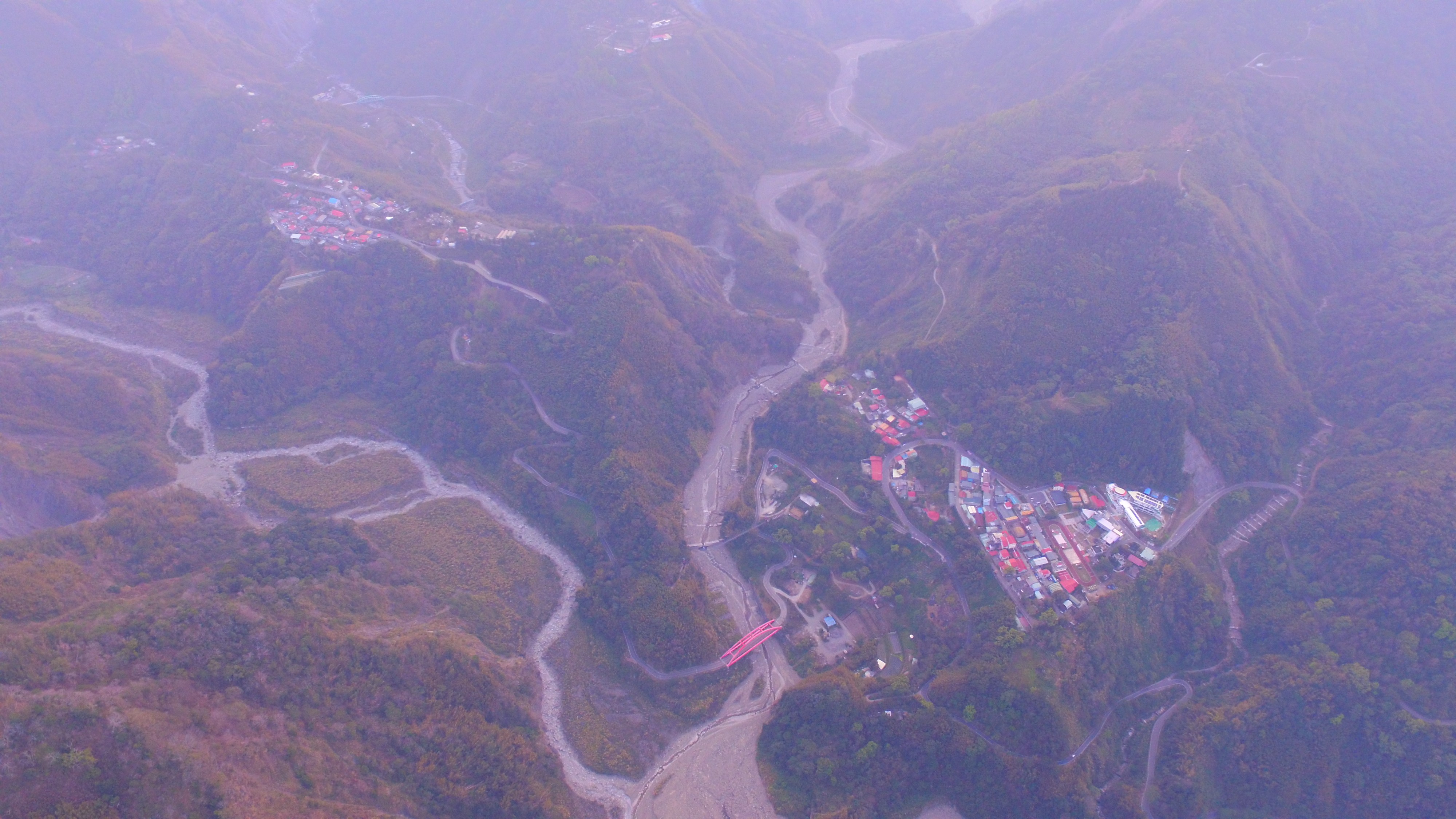
This is what my valleys look like with a bit of rainfall.

THE RIVER RUNS THROUGH IT

THE RIVER RUNS THROUGH IT
2017-3-4
Use props
fans9f85da53
lvl.3
Flight distance : 502982 ft
Offline

fansb1fe1104 Posted at 2017-3-3 09:49
There is a free app for your phone/tablet called UAV forecast...It gives you all the info you need to decide if the weather is good enough...You can also adjust the wind altitude to any height to see what the wind is at that height.

Great app. Thanks for the tip. Just downloaded it and I’ll be using it from now on. I have trouble with wind in my area so this will help me a lot. Thanks again
2018-5-31
Use props
fans9f85da53
lvl.3
Flight distance : 502982 ft
Offline

fansb1fe1104 Posted at 2017-3-3 09:49
There is a free app for your phone/tablet called UAV forecast...It gives you all the info you need to decide if the weather is good enough...You can also adjust the wind altitude to any height to see what the wind is at that height.

Thanks buddy. I’ll get it right now! Lots of wind in my area so this will help me tremendously.
2018-5-31
Use props
Advanced
You need to log in before you can reply Login | Register now

Credit Rules