Hello,
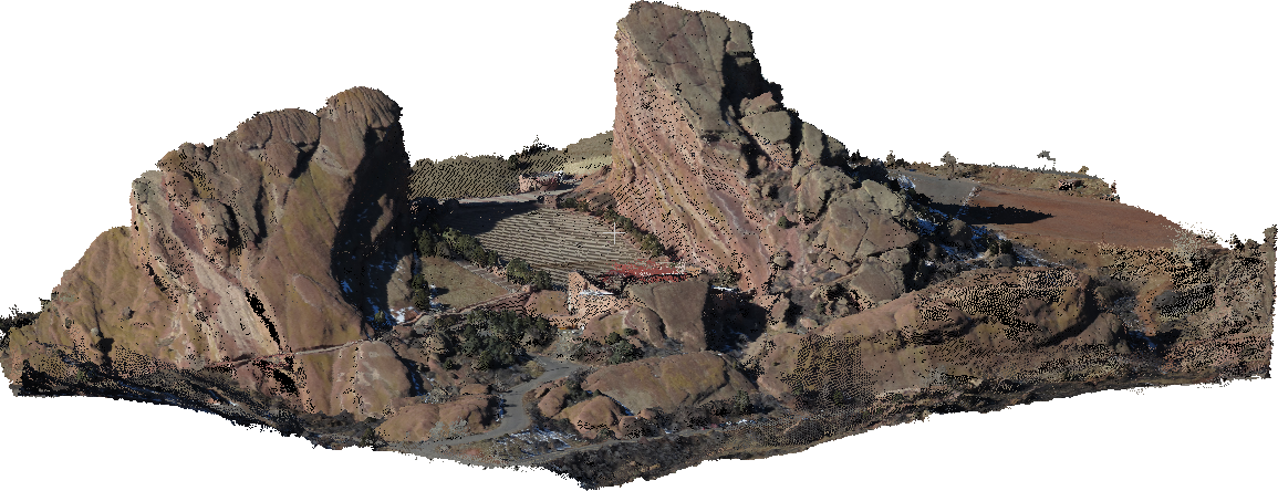
You can try DroneMapper's free RAPID for DJI software which works on Windows 10 64-bit. We have the ability to process oblique and/or NADIR imagery. The DJI version is free up to 150 images but has some limitations vs. the licensed versions. Here is an example of our Red Rocks, Colorado oblique example data set processed to a geo-referenced point cloud:
DJI Susan Posted at 2017-8-27 02:07
P4P+ doesn't support the third party APP for now. I would recommend you to use the P4P RC without built-in screen temporarily.
Based on your answer, can I assume that DJI is working on improving the P4P+ to receive/operate third party software? If so, is there any forecast for that?
Dronimagem Posted at 1-3 05:58
Based on your answer, can I assume that DJI is working on improving the P4P+ to receive/operate third party software? If so, is there any forecast for that?
Hi Dronimagem, please kindly refer to the release note here: https://forum.dji.com/thread-134274-1-1.html
Phantom 4 Pro+/Advanced+ remote controller supports up to 20 third-party apps, which you can add or remove through System Settings -> Apps.